

Beinn Challuim [Ben Challum]
Good walks are even better shared.
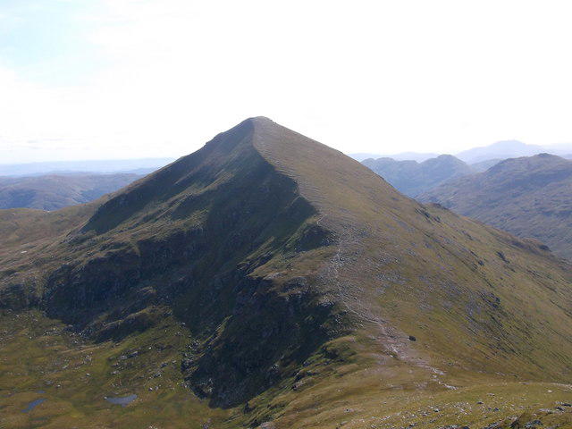
NN3832 : The south ridge of Ben Challum
Nigel Brown Photo source
Overview
Beinn Challuim [Ben Challum]
Ben Challum is a 1024.9 m Munro above Strathfillan near Tyndrum and Crianlarich. The main summit is beyond a separate 998.3 m South Top, which can hide it on the southern approach.
Route from Kirkton Farm
The complete out-and-back from the A82 layby near NN355281 is 11.5 km with 910 m of ascent, taking around 5–7 hours. The layby is on the west side of the road, just north of the Kirkton Farm turn. Cross the road carefully and follow the farm lane, then a short section of the West Highland Way past the chapel and burial grounds. Fork right onto the path to the railway footbridge. Use this bridge rather than historical level-crossing directions.
Above the railway, follow the faint path and fence line across very boggy slopes to the South Top. From there, turn briefly west to cross the cleft before following the ridge north. A short descent and further climb reach the main summit. Retrace the ridge to the South Top and return by the whole outward route to the layby. The distance and time cover this complete return.
This is a strenuous mountain walk with significant ascent, wet ground and navigation demands. A faint path is no guarantee of easy route-finding. Take particular care at the South Top in mist, and do not head blindly north or east towards steep ground. Carry mountain clothing and independent navigation; snow or ice requires appropriate winter skills and equipment.
Summit and views
The main summit cairn is at NN38688 32227. The South Top is at NN38640 31570, where the recorded high point is a boulder just west of its cairn. Reaching that lower top does not complete the ascent of Ben Challum.
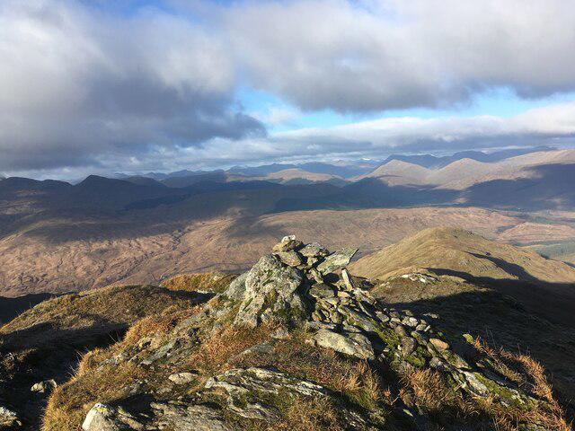
In clear conditions, the route and summit ridge offer views of Ben Lui, Ben More and Stob Binnein, Strathfillan and Glen Lochay.
Geology and name
The Ben Challum–Tyndrum area contains Dalradian metamorphic schists and quartzites. The Ben Challum Quartzite lies between the Ben Lawers and Ben Lui schists. These are metamorphosed sedimentary rocks.
Beinn Chaluim means “Calum/Malcolm’s mountain”. The name alone does not identify a particular historical person.
Access and facilities
Parking in the A82 layby is limited; do not obstruct access or assume the working farm provides parking. Citylink coaches and rail services reach Crianlarich and Tyndrum, but these village stops are separate from the walk’s start. Plan onward access and check your travel date and last return service.
Crianlarich has refreshments and public toilets. Check opening times before relying on them. There are no facilities on the mountain or at the layby.
Data credit
Hill data: The Database of British and Irish Hills v18.6 (https://www.hill-bagging.co.uk/dobih/), CC BY 4.0 (https://creativecommons.org/licenses/by/4.0/); wording adapted.
Explore routes near Beinn Challuim [Ben Challum]
Walks starting near this hill. Open a route to check its map, distance and full itinerary.
Killin: Falls of Dochart, Finlarig and Moirlanich Longhouse
View route
Loch Katrine: Trossachs Pier to Stronachlachar
View route
Loch Katrine: Brenachoile Point Shore Walk from Trossachs Pier
View route
The Cobbler from Succoth Carpark
View route
Route planning notes
These notes describe possible approaches. Check a route's map and access information when planning your walk.
Ben Challum from Kirkton Farm via the South Top
Complete out-and-back from the west-side A82 layby near NN355281, just north of the Kirkton Farm turn. Cross the road carefully, follow the farm approach and short West Highland Way section, pass the chapel and cemeteries, then fork right onto the path to the footbridge over the railway. Follow the faint, boggy hill path and fence line to the South Top. Turn a short way west to cross the cleft before following the ridge north, descending briefly then climbing to the main summit. Return over the South Top and retrace the entire outward route to the layby. Allow around 5–7 hours for the complete 11.5 km return, with approximately 910 m of ascent; adjust for your pace, stops and conditions.
Make a day of it, together
Find someone to share the walk with, or organise a day out along a route you like.
Photo Gallery
View all Photo could not load
NN3832 : The south ridge of Ben Challum
Nigel Brown
 Photo could not load
NN3832 : Eastern slopes of Beinn Challuim
Russel Wills
 Photo could not load
NN3832 : The summit of Ben Challum looking south
Colin Park
 Photo could not load
NN3832 : View over Glen Lochay
Russel Wills
 Photo could not load
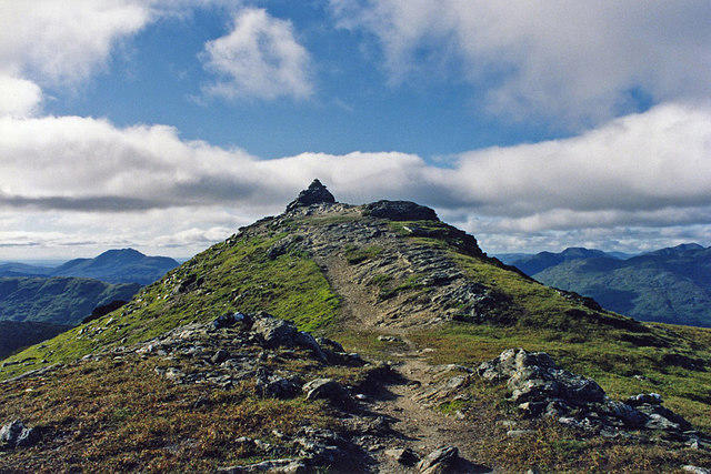
NN3832 : Towards the summit of Ben Challuim
Steven Brown
 Photo could not load
NN3832 : View from Ben Challum
wfmillar
 Photo could not load
NN3832 : Ben Challum : Munro No 106
Graham Ellis
 Photo could not load
NN3832 : Summit cairn on Beinn Challuim
Russel Wills
 Photo could not load
NN3832 : The Ridge of Beinn Challum
wfmillar

NN3832 : Summit, Ben Challuim
William Starkey
Hill facts and local notes
Classifications
Elevation
1,025m
3,363 ft
Prominence
450m
Coordinates
56.4546, -4.6192
NN386322
OS Map
50
Explorer: OL48W 377E 378W
At the Summit
A cairn marks the main summit at NN38688 32227, height 1024.9 m. The 998.3 m South Top at NN38640 31570 is a separate summit; its recorded high point is a boulder 3–4 m west of its cairn. Continue beyond the South Top by the westward cleft crossing and northward ridge to reach the main summit. Hill data: The Database of British and Irish Hills v18.6 (https://www.hill-bagging.co.uk/dobih/), CC BY 4.0 (https://creativecommons.org/licenses/by/4.0/); wording adapted.
Terrain & Geology
The Ben Challum–Tyndrum area lies within the Dalradian metamorphic belt. The area contains schists and quartzites, including the Ben Challum Quartzite between the Ben Lawers and Ben Lui schists. These are metamorphosed sedimentary rocks. Glacial deposits occur widely on surrounding valley slopes.
Views & Scenery
In clear weather the ascent and summit ridge give views towards Ben Lui, Ben More and Stob Binnein, over Strathfillan and down Glen Lochay.
History & Heritage
Name Origin
Beinn Chaluim means “Calum/Malcolm’s mountain”. The name alone does not establish which historical person was intended.
Historical Significance
It is considered an important peak for hillwalkers, contributing to the allure of the Munros in Scottish hiking culture.
Getting There & Facilities
Parking
Limited layby parking on the west side of the A82 near NN355281, just north of the Kirkton Farm turning. Park without obstructing access and cross the road carefully to the farm approach. Do not assume the farm itself provides public parking.
Public Transport
Citylink coaches serve Crianlarich and Tyndrum, and both villages have rail connections. These stops are separate from the Kirkton Farm layby start. Plan and verify onward access, the walking-day timetable and the last return service; no bus stop at the trailhead is confirmed here.
Nearby Facilities
Crianlarich has places to eat and public toilets. Check opening times before relying on any facility. There are no facilities on the mountain or at the described layby start.
Safety Information
Known Hazards
- The lower hill path is faint and extensively boggy; wet grass can be slippery on descent.
- At the South Top, turn west to cross the cleft before following the ridge north. Do not continue blindly north or east towards steep ground in mist.
- Use the railway footbridge in the current route description; do not follow historical directions onto a level crossing. Take care crossing the busy A82 at the start.
- Carry suitable mountain clothing and independent navigation, and allow time for the return over the South Top. Snow and ice demand appropriate winter skills and equipment.
General Safety Tips
- Check weather conditions before setting out
- Carry appropriate clothing and equipment
- Let someone know your planned route
- Take a map, compass, and GPS device
- Carry emergency supplies: food, water, first aid kit, torch
Hills
Some common questions about the hills answered
Are there group walks up Beinn Challuim [Ben Challum]?
Many walkers use Walkmates to join or organise walks with others. You can check for group walks around Beinn Challuim [Ben Challum] through the maps
Are there other walkers around Beinn Challuim [Ben Challum]?
Activity varies by location and time, but Walkmates lets you see whether others have shared walks or shown interest in this area. Find other people through the walking friends search walking friends for Beinn Challuim [Ben Challum] search or of course create your own walk for Beinn Challuim [Ben Challum]
Can I organise a walk to Beinn Challuim [Ben Challum]?
Yes. If there aren’t any walks listed already, you can create a walk and make it available for others to join.
If you're signed up to Walkmates, you can create a walk to Beinn Challuim [Ben Challum].
How do I find a walk up this hill?
There are often multiple ways to walk this hill, depending on experience and route preference. Walkmates helps you explore walks and routes that others have shared.
Can I suggest a new route up Beinn Challuim [Ben Challum]?
Yes. You can suggest or create routes to share with others. Walkmates focuses on the social side of walking, so routes are used to help people organise walks and explore areas together, rather than as detailed navigation tools or route libraries.
Other uses really appreciate knowledgeable walkers sharing their routes. Share your favourite route to Beinn Challuim [Ben Challum] here
The is an error or something incorrect about this hill. How do I let you know?
We always strive to keep the information on Walkmates as accurate as possible. If you find an error, please let us know through the contact form and we'll aim to correct it as quickly as possible
Community Discussion
Comments
Location
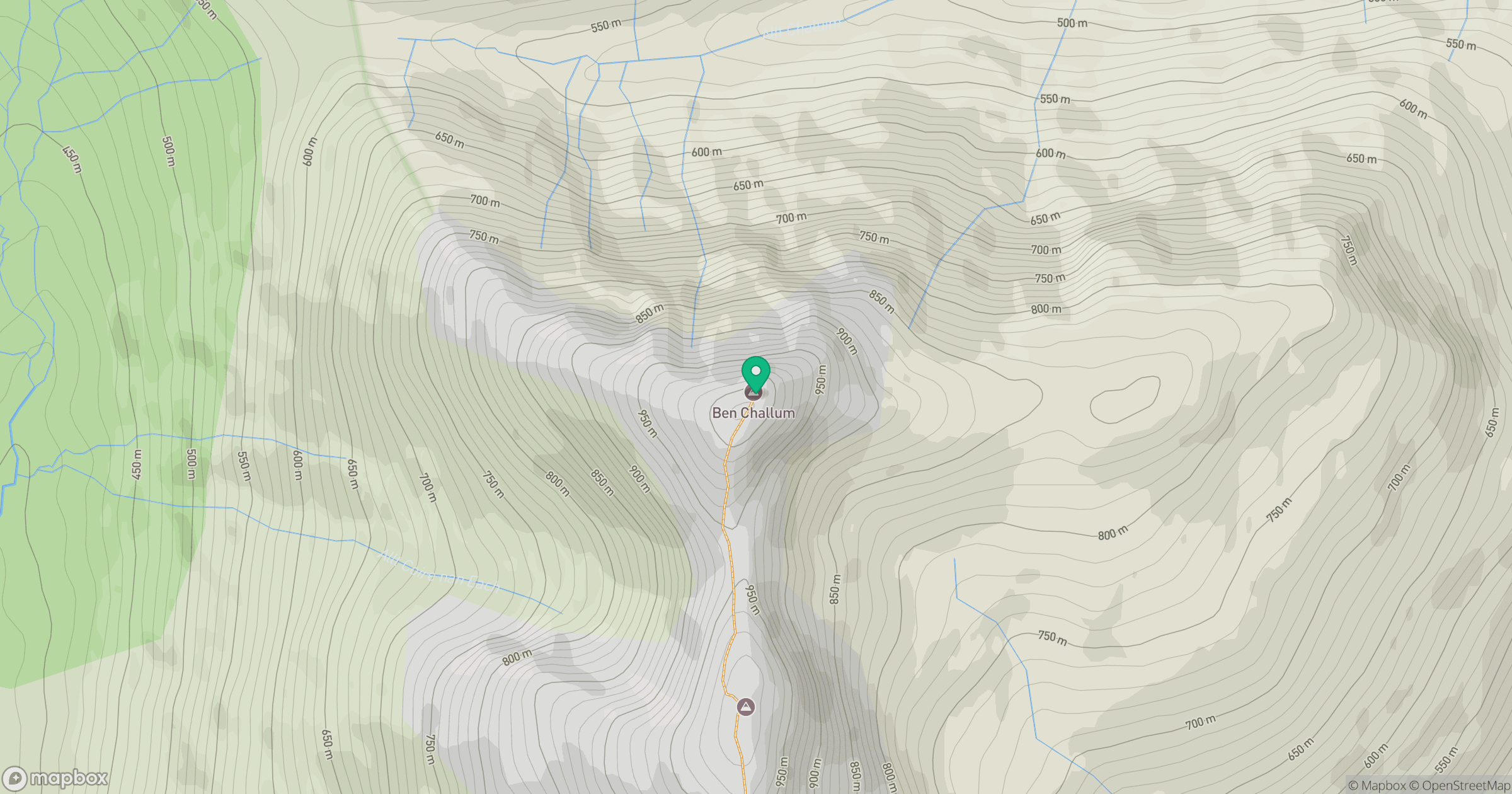
Grid reference: NN386322
View on OpenStreetMapOpens a map in a new tab, centred on the hill.
No comments yet. Be the first.